
At Donovan Surveyors, we’ve been providing dependable surveying services to the people of New Jersey for over 50 years, and topographic surveying in Somerdale, NJ, is one of our core specialties. Whether you’re planning a new construction project, evaluating land for grading, or making improvements to existing property, a topographic survey provides the precise, detailed information you need to make informed decisions.
We always use professional-grade equipment and time-tested methods to deliver results you can trust. Our team also specializes in creating accurate maps that reflect every relevant feature of the land — natural and man-made — along with detailed elevation data. This precision ensures that our clients, whether homeowners, contractors, or developers, can proceed with confidence.
What Is a Topographic Survey?
A topographic survey is a specialized form of land survey that focuses on identifying and mapping the physical features of a property. This includes natural terrain (hills, valleys, waterways) and man-made improvements (buildings, roads, fences, utilities). Most importantly, it provides detailed elevation data that’s critical for planning and design.
For example, if you’re working on a construction site survey in Somerdale, NJ, a topographic survey helps determine where and how structures can be built. It can also support land grading survey efforts, as well, ensuring water flows away from buildings and prevents drainage issues.
Topographic vs. Boundary Surveys
We often hear from clients who aren’t sure whether they need a boundary survey or a topographic survey. The difference is simple:
- Boundary Survey – Defines the legal property lines of a parcel of land. Essential for resolving disputes, building fences, or preparing deeds.
- Topographic Survey – Shows the land’s physical features and elevation changes. Critical for engineering, design, and construction planning.
While a boundary survey establishes “where” your property begins and ends, a topographic survey shows “what’s” on the property and “how” it lays. Many projects require both, and our team can provide both services so you have complete, accurate information.
Common Uses for a Topographic Survey
Our property survey in New Jersey services are used in a wide range of scenarios, including:
- Construction Planning – Providing engineers and architects with the elevation data they need for safe, compliant designs.
- Drainage and Grading Design – Mapping slopes to ensure proper water runoff and prevent flooding issues.
- Landscape Architecture – Helping designers understand the terrain for gardens, retaining walls, and outdoor features.
- Utility Placement – Locating underground and overhead utilities for safe and efficient installation.
- Permit Applications – Meeting the documentation requirements for local planning boards and zoning departments.

Why Precision Matters
In surveying, accuracy is everything. Even small errors can lead to costly construction delays, compliance problems, or design flaws. That’s why we invest in advanced equipment and maintain strict quality control procedures on every elevation survey in Somerdale, NJ, we perform.
Our decades of experience mean we know the local codes, regulations, and permitting requirements inside and out. This ensures your survey not only meets professional standards but is also fully compliant with municipal and state guidelines.
Our Process
When you work with Donovan Surveyors, we make the surveying process straightforward and stress-free:
- Consultation – We’ll discuss your project, goals, and timelines to determine the type of survey you need.
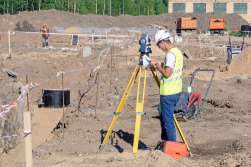
- Site Visit – Our team uses professional-grade GPS, total stations, and other precision tools to collect accurate data on-site.
- Mapping – We convert field data into a detailed map showing elevations, contours, and site features.
- Review – We review the survey results with you, explaining every detail in clear, simple terms.
- Delivery – You receive a final survey package that’s ready for use by architects, engineers, contractors, or permitting authorities.
Why Choose Donovan Surveyors?
- Experience You Can Trust – Over 50 years serving New Jersey with a strong reputation for accuracy and reliability.
- Advanced Technology – Professional equipment and software for precise measurements and mapping.
- Full-Service Expertise – From topographic surveys to flood elevation certificates, we provide a full range of surveying services.
- Client-Focused Approach – We take the time to explain our findings and answer your questions.
- Local Knowledge – Deep understanding of Somerdale’s terrain, zoning regulations, and construction standards.
Service Area
While we specialize in topographic surveying in Somerdale, NJ, our service area extends across New Jersey. We routinely assist clients in neighboring towns and counties, providing consistent, high-quality surveying for both residential and commercial projects.
Frequently Asked Questions
Do I need both a boundary and topographic survey?
If your project involves both determining property lines and planning site work or construction, having both surveys is ideal. We can perform them together for efficiency.
How long does a topographic survey take?
For most residential lots, we can complete the fieldwork in a day and deliver results within a week. Larger or more complex properties may take longer.
Is a topographic survey required for a building permit?
Many municipalities require them for new construction, grading, or major landscape changes. We can provide the documentation you need for your permit application.
Can you survey sloped or wooded land?
Absolutely. Our equipment and expertise allow us to handle properties with challenging terrain or heavy vegetation.
Accurate, Detailed Mapping for Smarter Land Use and Development
At Donovan Surveyors, we believe that great projects start with great information. With this in mind, our land survey uses range from home improvements to large-scale developments, and our construction site survey in Somerdale, NJ, services ensure you have the data you need to build safely, efficiently, and in compliance with local codes.
So if you need a land grading survey or an elevation survey in Somerdale, NJ, we’re ready to deliver precise results with a personal touch. All you have to do is reach out and contact us today to schedule your survey, and see how over five decades of expertise can make your project smoother, faster, and more successful.